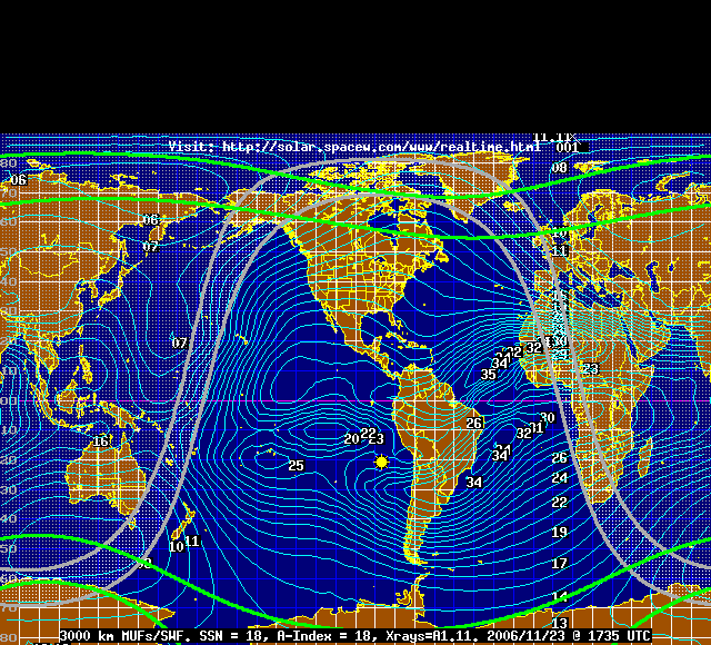
Near-Real-Time MUF map
The following map shows Maximum Usable Frequencies (MUFs) for 3000 kilometer radio signal paths. More importantly, the current sunspot number (SSN) and Planetary A-index are updated every 30 minutes on the bottom of this image. Additionally, the grey line position, auroral ovals, and sun position are provided.
posted by World Radio Club at 9:42 AM
![]()

0 Comments:
Post a Comment
<< Home